Sahel
 | |
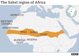
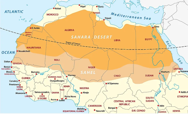
The Sahel is a region in Africa that is defined as the ecoclimatic and biogeographic realm of transition between the Sahara to the north and the Sudanian savanna to the south. Having a hot semi-arid climate, the Sahel region stretches across the south-central latitudes of Northern Africa between the Atlantic Ocean and the Red Sea.[1]
The Sahel region includes – from west to east – parts of northern Senegal, southern Mauritania, central Mali, northern Burkina Faso, the extreme south of Algeria, southern Niger, the extreme north of Nigeria, Cameroon and Central African Republic, central Chad, central and southern Sudan, the extreme north of South Sudan, Eritrea, and the extreme north of Ethiopia.[2]
Historically, the western part of the Sahel was sometimes known as the Sudan region, located between the Sahara and the coastal areas of West Africa.
There are frequent shortages of food and water due to the dry harsh climate.[3] This is exacerbated by the population increasing rapidly due to very high birthrates across the region; Niger has the world's highest fertility rate.[4]
Jihadist insurgent groups including Boko Haram, Islamic State, and al-Qaeda frequently carry out major attacks in some parts of the western Sahel.[5]
References
Wikipedia is not affiliated with Wikispooks. Original page source here
